Navigating LOMR flood maps is essential for US property owners, especially Gen Z and Millennials considering real estate investments. A Letter of Map Revision LOMR officially changes FEMA flood hazard zone designations on a Flood Insurance Rate Map FIRM. Understanding these revisions directly impacts your flood insurance premiums property value and future development plans. This guide offers crucial insights into locating interpreting and leveraging LOMR information to protect your assets. It provides actionable steps to assess flood risk verify changes and potentially reduce insurance costs ensuring you make informed decisions about your property. Learn how these critical maps influence everything from mortgages to building permits.
- What is a Letter of Map Revision LOMR flood map? - A LOMR is an official FEMA document that amends an effective Flood Insurance Rate Map FIRM. It revises flood hazard zones, floodways, or flood insurance rate zones for specific properties or areas based on new data or physical changes, directly influencing flood insurance requirements.
- How does a LOMR impact property owners and flood insurance costs? - A successful LOMR can remove a property from a high-risk flood zone. This can make flood insurance optional instead of mandatory, potentially leading to significant reductions in annual premiums and increasing property value by mitigating perceived flood risk for buyers and lenders.
- Where can I find official LOMR flood map images and data online? - Official LOMR flood map images and comprehensive data are primarily available through the FEMA Flood Map Service Center MSC website. Simply enter your property address or location to access the latest flood maps and any associated LOMR documents applicable to your area.
- Who is eligible to apply for a LOMR and what are the benefits? - Property owners, developers, and community officials are eligible to apply for a LOMR. The primary benefit is reducing or eliminating mandatory flood insurance requirements, saving money, and potentially increasing property appeal by demonstrating a lower flood risk designation.
- What documentation is required for a LOMR application to FEMA? - A LOMR application typically requires a certified Elevation Certificate, detailed topographic survey data, and hydrological or hydraulic analyses that accurately demonstrate changes in flood elevations or boundaries that justify the map revision request to FEMA.
- How long does it typically take for FEMA to process a LOMR application? - The processing time for a LOMR application can vary significantly. It generally takes several weeks to a few months, depending on the complexity of the data submitted, the completeness of the application, and FEMA's current workload for map revision requests.
- Can a LOMR affect my property's resale value or building permits? - Yes, a favorable LOMR that removes a property from a high-risk flood zone can positively impact its resale value and simplify the process for obtaining building permits by reducing regulatory hurdles related to flood-resistant construction requirements.
- What is a LOMR flood map? A Letter of Map Revision LOMR is a formal document issued by FEMA that officially changes or amends an effective Flood Insurance Rate Map FIRM or Flood Boundary and Floodway Map FBFM for a specific property or area.
- How does a LOMR affect my flood insurance? A successful LOMR can remove your property from a high-risk flood zone, making flood insurance optional instead of mandatory, and often leading to significantly lower premiums.
- Where can I view LOMR flood maps online? You can view LOMR flood maps and other flood hazard data directly on the FEMA Flood Map Service Center MSC website by entering your property address.
- Who can apply for a LOMR? Property owners, developers, and community officials can apply for a LOMR if they have data demonstrating that an area's flood risk designation is incorrect.
- What information do I need to apply for a LOMR? You typically need a certified Elevation Certificate, detailed topographic data, and hydraulic analysis to support your application to FEMA.
- How long does the LOMR process take? The processing time for a LOMR application can vary, typically ranging from a few weeks to several months, depending on the complexity and completeness of the submission.
- Can a LOMR increase my flood risk or insurance? While rare, a LOMR could technically designate an area as higher risk if new data proves it. However, most LOMR applications aim to reduce perceived flood risk.
For US property owners, especially those navigating the real estate market, understanding a Letter of Map Revision (LOMR) flood map is crucial. A LOMR is an official amendment issued by the Federal Emergency Management Agency (FEMA) to an effective Flood Insurance Rate Map (FIRM) or Flood Boundary and Floodway Map (FBFM). This document officially changes the flood hazard zone, floodway designation, or flood insurance rate zone for a specific property or area. These revisions directly impact flood insurance premiums, property values, and future development decisions, making them a cornerstone of responsible property ownership across the United States.
Understanding LOMR Flood Maps
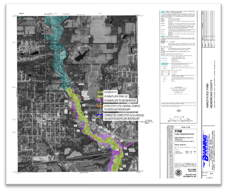
A LOMR signifies that updated topographic information or changes in land use have altered the perceived flood risk for a particular area. Property owners, developers, or communities can initiate a LOMR request if they believe their property has been incorrectly designated within a high-risk flood zone. The outcome of a successful LOMR application can mean a significant reduction in flood risk designation for the property, moving it out of a special flood hazard area (SFHA), which in turn can lead to lower flood insurance costs or even the elimination of mandatory flood insurance requirements. This process involves detailed hydrological and hydraulic analysis to demonstrate changes in flood elevation or boundaries.
Why LOMR Maps Matter for Your Property
The implications of LOMR flood maps are substantial for homeowners and prospective buyers. First, an updated LOMR can directly impact your flood insurance rates, potentially saving thousands of dollars annually. Second, property value can increase if a home is moved out of a high-risk flood zone, making it more attractive to buyers and lenders. Third, for those planning new construction or significant renovations, understanding LOMR changes is vital for compliance with local building codes and FEMA regulations. Ignoring these maps can lead to unexpected costs, permit denials, and inadequate insurance coverage, leaving property owners vulnerable to financial hardship in the event of a flood. Always verify the latest FEMA flood zone information for any property you own or plan to purchase.
How to Access and Interpret LOMR Data
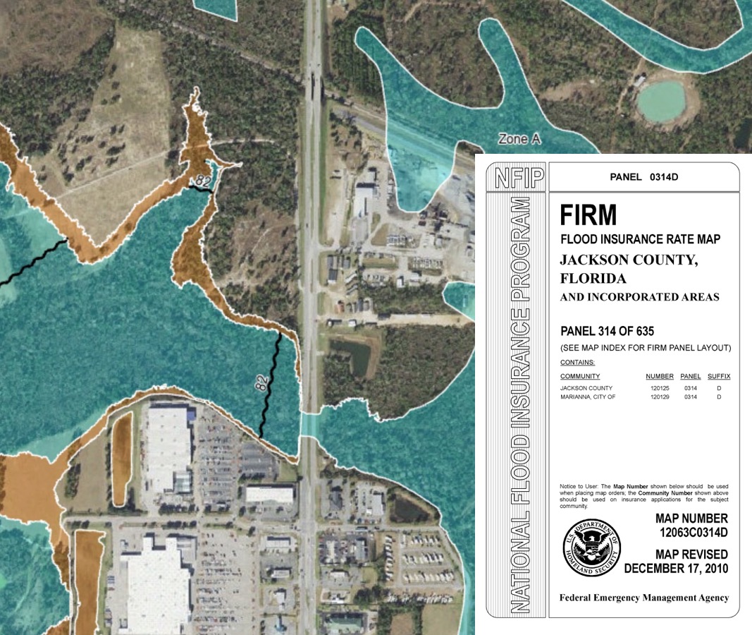
Accessing LOMR data typically involves visiting the FEMA Flood Map Service Center (MSC) website. Here, you can input an address to view effective flood maps and any associated LOMRs for a specific area. Additionally, your local community's planning or engineering department often maintains copies of effective flood maps and LOMRs, providing localized assistance and interpretations. Interpreting these maps requires understanding the various flood zone designations, such as Zone A (areas with a 1 percent annual chance of flooding) and Zone X (areas of minimal flood hazard). Pay close attention to the Base Flood Elevation (BFE), which indicates the expected height floodwaters will reach during a 100-year flood event, as this impacts building requirements and insurance ratings.
Frequently Asked Questions
Where can I find official LOMR flood maps in the US?
The absolute best locations to find official LOMR flood maps in the US are the FEMA Flood Map Service Center online and your local community's planning or engineering department for property-specific details.
Are LOMR flood map images or printable versions available for viewing?
Yes, LOMR flood map images are readily available. Pull up your preferred mobile images app or visit FEMA's Flood Map Service Center to verify real-time map images. Printable versions are accessible directly from FEMA's website for download.
What are the best times to consult with experts about LOMR maps?
It is highly practical to consult with experts, such as a certified flood plain manager or a surveyor, during these key periods:
- When purchasing a new property to understand inherent flood risks.
- Before starting any new construction or significant renovation projects.
- Annually, before your flood insurance policy renews, to confirm current designations.
For more detailed information, consider these valuable resources:
Business Name: FEMA Flood Map Service Center, Neighborhood / Cross-streets: National, Online Resource
Business Name: Your Local City Planning Office, Neighborhood / Cross-streets: Specific Municipality
Business Name: Licensed Land Surveyor, Neighborhood / Cross-streets: Property Specific
LOMR flood maps officially revise FEMA flood zones impacting insurance and property value. Access and interpret these maps via FEMA or local planning offices. Understanding LOMRs can reduce flood insurance costs.
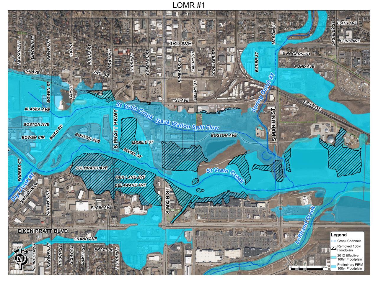
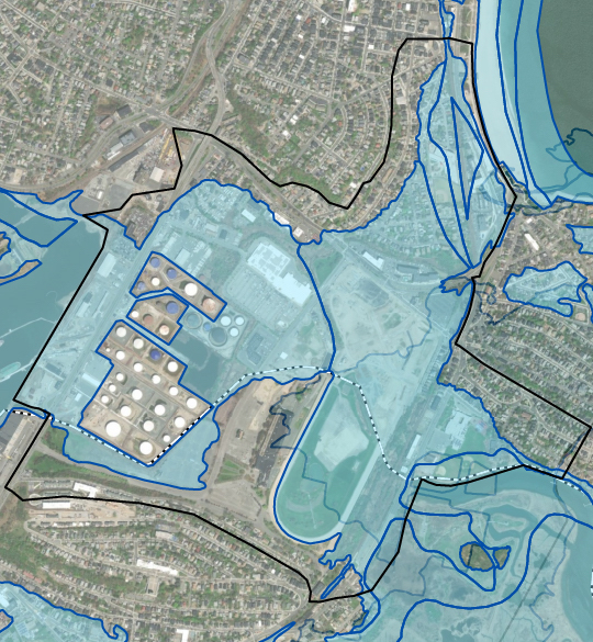
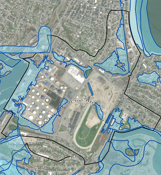


Resilient St Vrain Project City Of Longmont 25325. LOMR Suffolk Downs 02 Current . LOMR Suffolk Downs 03 Revised 1 . Werner Water Engineering LLC Services Rs=w 600,h 600,cg True. DNR Water LOMR CLOMR Application Processing Wa Lomr Map Marion

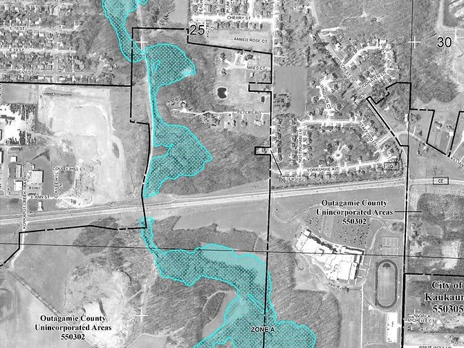


Harris County Flood Control District Model And Map Maintenance Program Continuous Update LOMR . Land Surveying Services Martenson Eisele FIRM Map Edited . Mapas De Revisados FEMA City Of Worthington Fema Lomr Wording For Website Spanish Page 4 . Mapas De Revisados FEMA City Of Worthington Fema Lomr Wording For Website Spanish Page 3 . Flood Coast Engineering Floodplain Firm



DNR Water LOMR CLOMR Application Processing Wa Lomr Map . Illinois Flood Maps LOMR Review Lomr Sidebar . Harris County Flood Control District Model And Map Maintenance Program Continuous Updates With LOMR Delegation . Flood Map For Planning Enhanced Data And New Features Coming March 2025 Flood Map For Planning Enhanced Data And New Features Coming March 2025 . The Flood Map 2026 Is Your House At Risk Flood Map 2026


Data ReFined 17 Announcing CYCLOPS Next Generation Natural Capital IMAGE NOAA New Flood Inundation Map 092723 NOAA . Louisiana Water Boundaries NOAA Expands Flood Inundation Mapping To Map Legend . Fema Floodway Maps Group Flood Insurance Policy Fact Sheet PFYUZ Fema Flood Map 23 . Floodplain Updated For Blue River Properties McKenzie Community Partners New Floodplain Map LOMA LOMR 2022 . National Weather Service Office Of Water Prediction Sfo Final 2026 600x388



From The Desk Of Max Kolb LOMR Banning Engineering Picture2 . CTP Webinar Letter Of Map Revisions MT 2s Flood Science Center LOMR MT2 Webinar Img . CLOMR Vs LOMR Definition Frisco Civil Engineering Clomr Vs Lomr Definition Infographic . Illinois Flood Maps 4 Lomr . LOMA Vs LOMR How To Use FEMA Map Amendments To Exit Zones Image


.gif)

City The City Wants To Let Residents Know That FEMA Federal Emergency Media. What Is A LOMR Floodzone Revisions Lomr01 Pi0w 200x155 . Letter Of Map Change FEMA Region III Image 6 . MRD Processes CLOMR S LOMR S And LOMA S For Developers And Residences Ezgif.com Resize(1) . Steps To Remove Your Property From The FEMA Floodplain LOMA LOMR WGI LOMRsnip

Hanstad Engineering Services Floodplain Modeling Expert Support Lomr Image . Project Local Flood Risk Management Strategy 2026 2032 London E386f3ee 5eec 49bf 8510